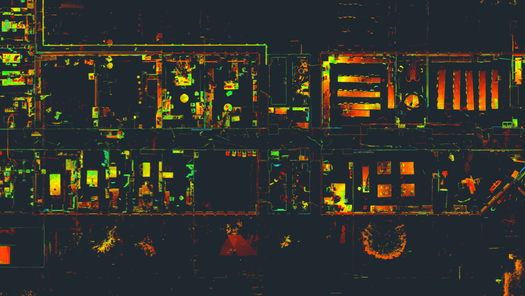
3D Laserscanning
3D laserscanning is a modern surveying method in which the environment is digitized into point coordinates. All objects are captured by a laser and, depending on the resolution, precisely digitized into a grid with points accurate to millimeters. The 3D laser scanner can capture several million points extremely accurately in just a few minutes. At first glance, the result in an empty space may appear to be a random collection of points, which is why it’s referred to as a “point cloud.”
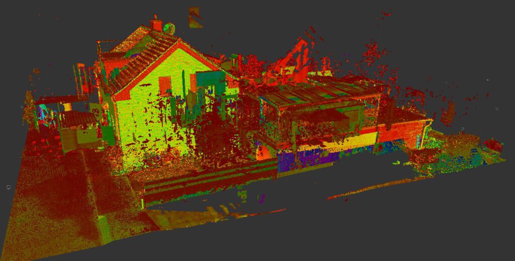
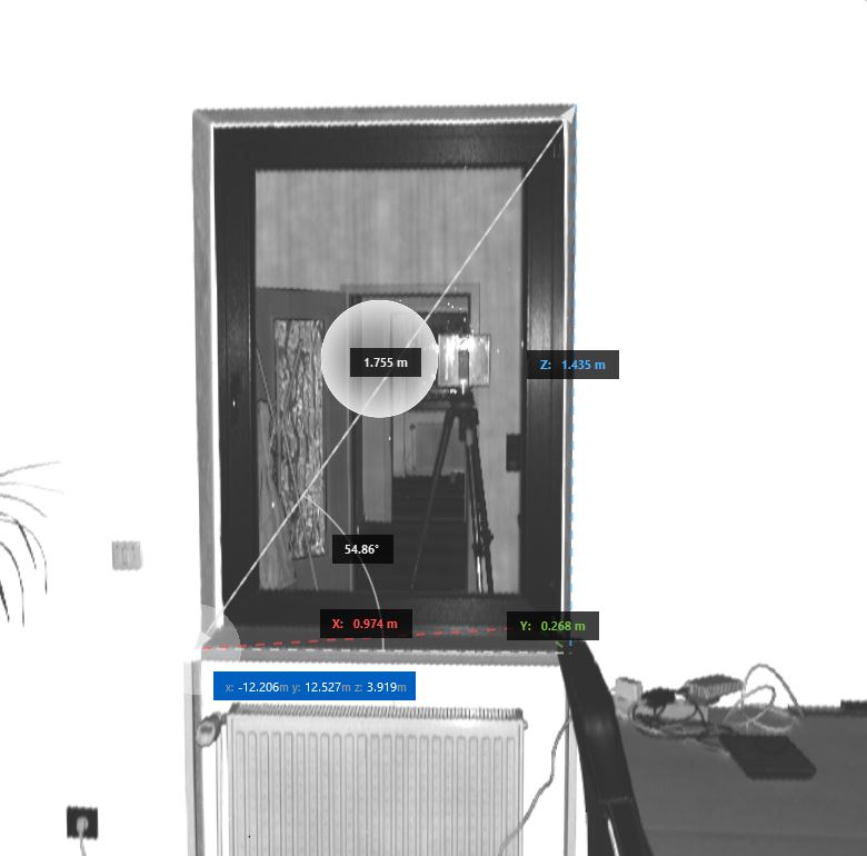
Naturally, there’s a system behind it, as the points are precisely arranged in a grid and represent all objects visible to the human eye in points. Since each point is positioned in a coordinate system, we can extract distances, heights, and angles from the point cloud and conveniently take measurements from the digitized area.
To digitize a complete structure like a building in the form of a point cloud, there are two 3D laser scanning methods: terrestrial laser scanning (TLS or static scanning) and mobile laser scanning (Mobile Scanning). Both methods have their advantages and disadvantages. Static scanning (TLS) is very precise and has a long range, but it requires more time for data acquisition and point cloud preparation. On the other hand, mobile scanning is quick and easy to carry out but sacrifices some accuracy and range. Thus, mobile scanning should only be used for simpler structures.

Data Acquisition
When surveying a structure, depending on the client’s requirements and the building’s conditions, a measurement team of 1 to 3 people will perform the survey. Accessibility to all areas must be ensured. Only what is visible and accessible can be measured.
To measure general structures like walls, columns, stairs, etc., in a building, rooms do not need to be emptied out. The survey can take place parallel to the normal daily routine. If specific components or technical equipment (e.g., access openings, electrical outlets, ventilation systems, etc.) need to be captured, it’s imperative to clear them beforehand. The rule is: Only visible elements can be measured and captured.
Static Scanning (TLS)
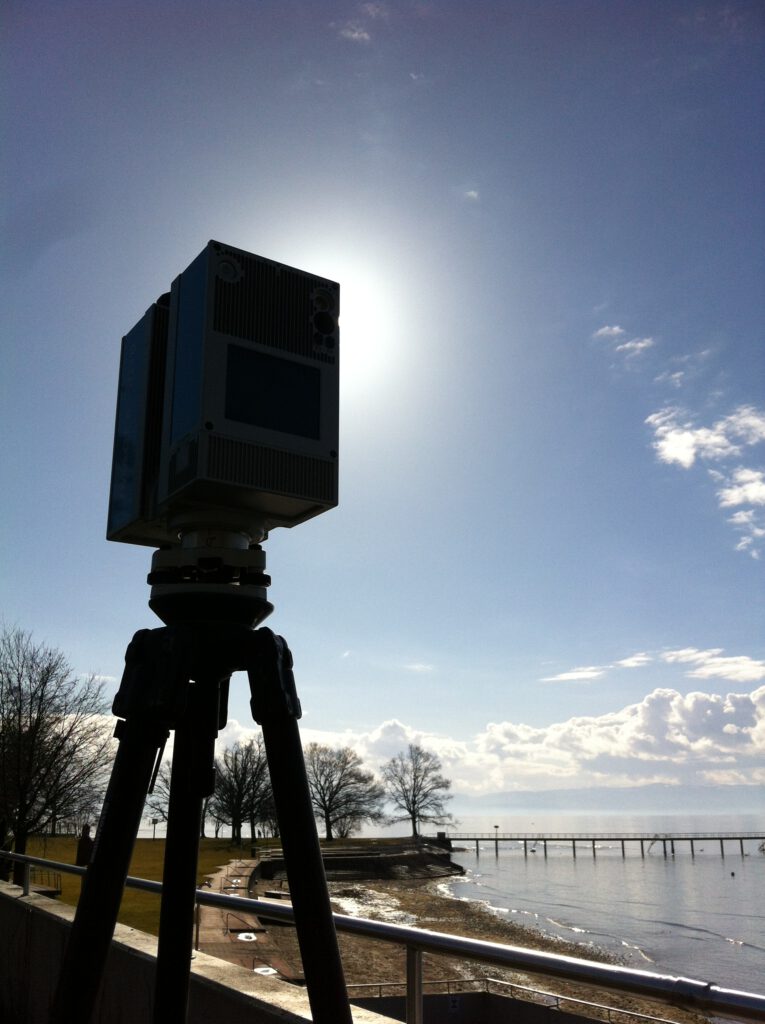
In this method, the scanner is set up in the room using a tripod about 2-3 times. The number and duration of scan positions can vary based on requirements. The duration varies depending on scan accuracy, ranging from 1 to 5 minutes per scan position. On average, about 10 minutes per room can be expected. The scans are later linked together to represent the entire building as a point cloud.
Mobile Scanning
Due to the flexibility of mobile scanning, the measurement team needs to move through the building’s rooms at a consistent speed of around 4 km/h. If room doors cannot remain open, an additional person is required to open and close the doors. Depending on the building’s size, a single scanning process may suffice; for larger objects, multiple scans need to be created. The scans are later linked together to represent the entire building as a point cloud.